GEOINFORMATICS LABORATORY
The GeoInformatics Laboratory (GIL) acts as a focus for research into geoinformatics across the School of Earth Environment and Society (SEES) and other disciplines at the University. Geoinformatics involves a range of different synergetic activities including the collection, processing, analysis and visualization of spatial data sets. This emphasis on multidisciplinary approaches creates a strong focus on different application areas including environmental problem-solving, human-environment interactions, collaborative spatial decision-making, and other cross-disciplinary approaches that use applications of geographic information science (GIScience) and remote sensing.
Examples of the areas of study of our team of researchers features a strong focus on geomorphometric analysis and digital terrain representation, modeling landslide processes under undisturbed and disturbed conditions, computational approaches for understanding potential avian impact from offshore wind farms, predicting invasive species in wetland environment and other remote sensing land use approaches aimed at inventory, monitoring and modeling of conditions. The most current research projects underway are in the area of web-based GIS, such as collaborative spatial decision support systems (C-SDSSs), public participatory GIS (PPGIS), volunteered geographic information (VGI), and 3D geo-information derived from laser scanning techniques.
Examples of the areas of study of our team of researchers features a strong focus on geomorphometric analysis and digital terrain representation, modeling landslide processes under undisturbed and disturbed conditions, computational approaches for understanding potential avian impact from offshore wind farms, predicting invasive species in wetland environment and other remote sensing land use approaches aimed at inventory, monitoring and modeling of conditions. The most current research projects underway are in the area of web-based GIS, such as collaborative spatial decision support systems (C-SDSSs), public participatory GIS (PPGIS), volunteered geographic information (VGI), and 3D geo-information derived from laser scanning techniques.
ONGOING EVENTS
Check our most recent events, updates and deadlines.
- Congratulations to Finhas Tsehaye Zerai on his successful thesis defense !
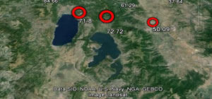
The thesis title is: Mineral prospectivity mapping using integrated remote sensing and GIS in Kerkasha- Southwest Eritrea
- Congratulations to Michael Kofi Amoah on his successful thesis defense !
Congratulations to Michael Amoah on his successful thesis defense ! Michael's research involved predicting land use land cover changes and impact on wetlands using cellular automata and artificial neural networks approach, a case study in Greater Accra, Ghana
- New Pub ! The latest publication will appear soon !
New Pub! The latest publication will appear soon in Natural Resources Research. Congratulations to our former student Finhas Tsehaye Zerai ! For more information check the articles in press.
- Congratulations to Alberto Torregrosa on his new article!
Congratulations to Alberto Torregrosa on his article in Geospatial Data in a Changing World, Lecture Notes in Geoinformation and Cartography that implements Android-based PPGIS [more]
- A new degree, Master of Science in Applied Geospatial Science (MSAGS)
A new degree, Master of Science in Applied Geospatial Science (MSAGS) was approved in 2014. See for more details on the SEES website [more]
- GIL seeks new graduate students
GIL seeks new graduate students. See for more details here [more]
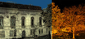
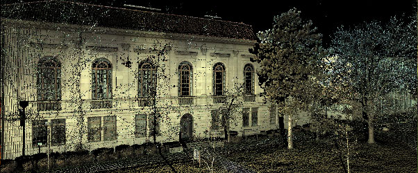
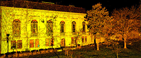
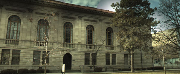
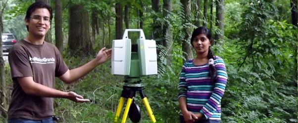
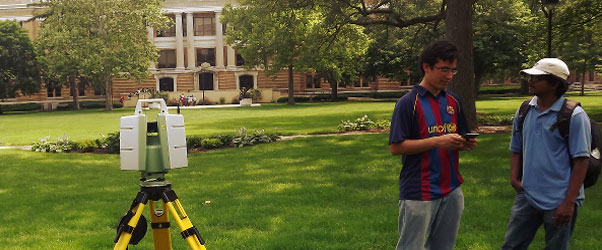
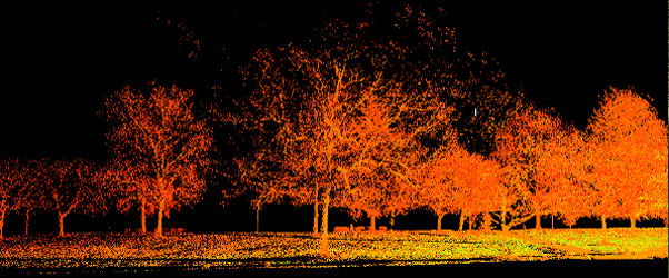
Relationship between Leaf Area Index (LAI) estimated by terrestrial LiDAR and ...
The research uses a terrestrial laser scanning (TLS), also known as ground-based LiDAR
(Light Detection and Ranging) which has been used as an alternative indirect method for quantifying aboveground ...
[more]
Realtime geospatial computations and presentation using R
An application of analysing climatic data from
Macedonia using R demostrating its power of geospatial data
processing and analysing capabilities.
[more]
Latest research
Here you would find our latest research including LiDAR remote sensing, participatory GIS and realtime computations ...
[more]